XIZANG AUTONOMOUS REGION – 中國 / 西藏自治區
“TIBET” – 西 藏

“Tibet” (pronounced “Bod”) in the Tibetan script (top).
“Tibet” (pronounced “Xi Zang”) in Chinese script (bottom).
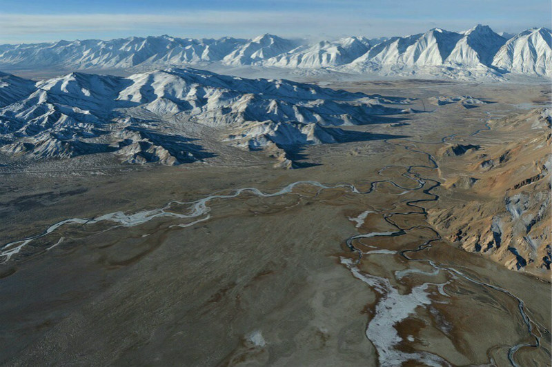
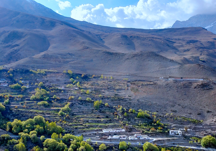
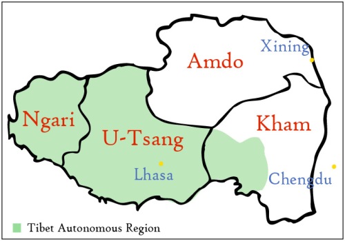
མངའ་རིས་ས་ཁུལ། – Ngari Prefecture – 阿里地區
COUNTRY PROFILES – 檔案
- WIKIPEDIA – 維琪百科
- wikipedia.org – Ngari Prefecture @ Wikipedia . org
- wikipedia.org – Ancient dynastic kingdom of Guge @ Wikipedia . org
- wikipedia.org – Father Antonio de Andrade @ Wikipedia . org
- wikipedia.org – Guge Kingdom @ Wikipedia . org
- wikipedia.org – Zjangzhung @ Wikipedia . org
- wikipedia.org – Tsaparang @ Wikipedia . org
- wikipedia.org – Ladakh Chronicles @ Wikipedia . org
- BACKGROUNDERS – 背景
- alchetron.com – Ngari Prefecture – backgrounder @ Alchetron . com
- ngarifoundation.org – Ngari Foundation – website
- mdpi.com – Quantifying trends of land change in Tibet 2001-2015.
- hktdc.com – Major economic indicators for Ngari Prefecture @ Trade Development Council of Hong Kong
- tibetanlife.com – Timeline of Tibet History @ Tibetan Life . com
- balkhandshambhala.com – Ngari and the Guge Kingdom @ Balkhandshambhala . com
- savetibet.org – Daming Tibet’s rivers for hydropower – backgrounder @ Save Tibet . com
- tibet.cn – Ngari Prefecture – backgrounder
- images.google.com – Ngari Prefecture @ Google Images
- images.bing.com – Ngari Prefecture @ Bing Images
- youtube.com – Ngari Prefecture @ YouTube . com
- videos.google.com – Ngari Prefecture @ Google Videos
- videos.bing.com– Ngari Prefecture @ Bing Videos
- books.google.com – Ngari Prefecture @ Google Books
AIRPORTS – 機場
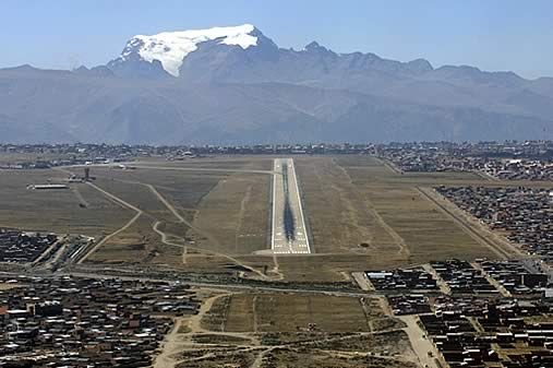
- Ngari Günsa Airport (IATA: NGQ, ICAO: ZUAL).
- (Also known as Shiquanhe Airport).
- 阿裡昆莎機場
- wikipedia.org – Ngari Günsa Airport @ Wikipedia . org
- people.cn – Ngari Günsa Airport – backgrounder
- chinadaily.com.cn – Ngari Günsa Airport – backgrounder
- exploretibet.com – Ngari Günsa Airport – backgrounder
- tibettravel.org – Ngari Günsa Airport – backgrounder
- skyrefund.com – Ngari Günsa Airport – backgrounder
- tourtraveltibet.com – Ngari Günsa Airport – backgrounder
- topchinatravel.com – Ngari Günsa Airport – backgrounder
- flightaware.com – Ngari Günsa Airport – backgrounder
- radarbox.com – Ngari Günsa Airport – backgrounder
- airportcodes.io – Ngari Günsa Airport – backgrounder
- airportguide.com – Ngari Günsa Airport – backgrounder
- metar-taf.com – Ngari Günsa Airport – backgrounder
- mapcarta.com – Ngari Günsa Airport – backgrounder
- skybrary.aero – Ngari Günsa Airport – backgrounder
- world-airport-codes.com – Ngari Günsa Airport – backgrounder
ATTRACTIONS – 景點
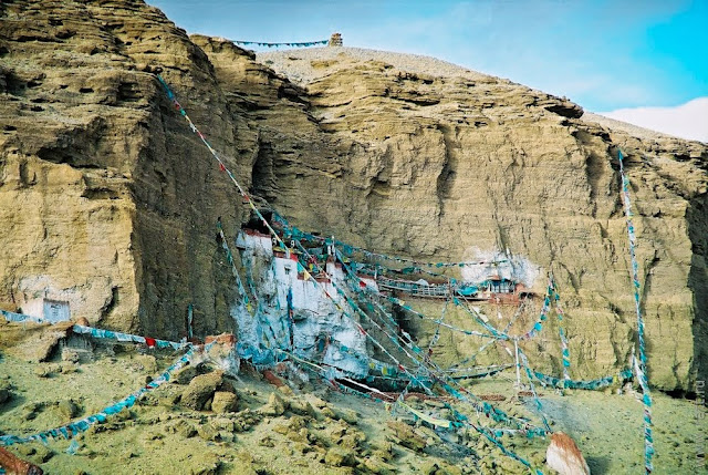
- tibettravel.org – Attractions in Ngari @
- snowliontours.com – Attractions in Ngari @ Show Lion Tours
- tibettravelers.com – Attractions in Ngari @ Tibet Travelers . com
- windhorsetour.com – Attractions in Ngari @
- tibetlocalguide.com – Attractions in Ngari @
- tibetctrip.com – Attractions in Ngari @
- zudong.com – Attractions in Ngari @
- topchinatravel.com – Attractions in Ngari @
- mysterioustibet.com – Attractions in Ngari @
- tibettravel.org – Attractions in Ngari @
- greattibettour.com – Attractions in Ngari @
- itibettravel.com – Attractions in Ngari @
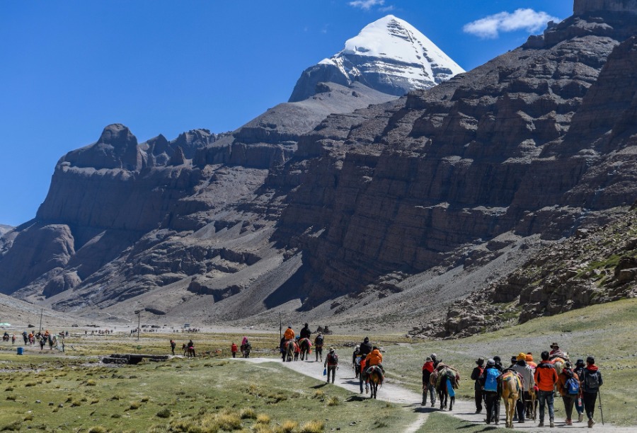
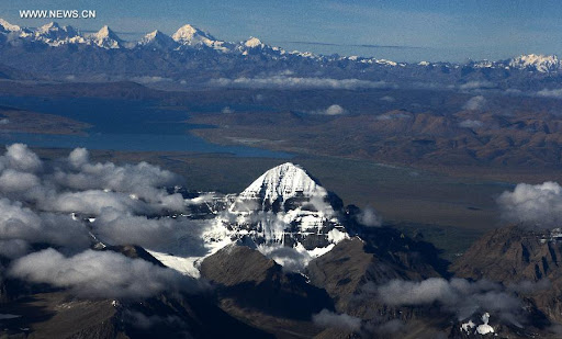
- MT. KAILASH
- tibettravel.org – Mt. Kailash – backgrounder
- tibetantrekking.com – Mt. Kailash – backgrounder
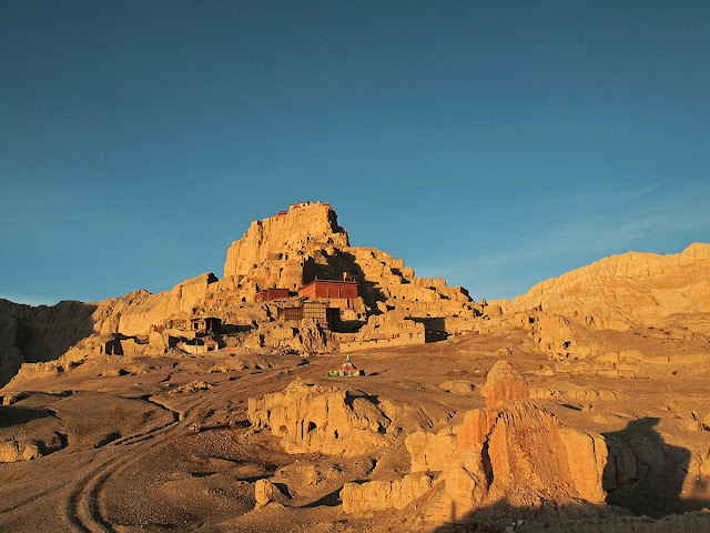
- GUGE KINGDOM
- wikipedia.org – Guge Kingdom – backgrounder
- wikipedia.org – Guge Kingdom – backgrounder
- kailash-yatra.org – Guge Kingdom – backgrounder
- wondersoftibet.com – Guge Kingdom – backgrounder
- tibetfocus.travel – Guge Kingdom – backgrounder
- globalsecurity.org – Guge Kingdom – backgrounder
TRAVELERS’ SCRAPBOOKS – 旅遊者剪貼簿
- tibetantrekking.com – Traveler’s scrapbook for Ngari @
- tibettravel.org – Traveler’s scrapbook for Ngari @
- claudearpi.com – Traveler’s scrapbook for Ngari @
- claudearpi.com – Traveler’s scrapbook for Ngari @
- yoair.com – Traveler’s scrapbook for Ngari @
- itibettravel.com – Traveler’s scrapbook for Ngari @
- chinaalacarte.com – Traveler’s scrapbook for Ngari @
- mysterioustibet.com – Traveler’s scrapbook for Ngari @
- topchinatravel.com – Traveler’s scrapbook for Ngari @
- greattibettour.com – Traveler’s scrapbook for Ngari @
- discoverchinatours.com – Traveler’s scrapbook for Ngari @
- tibettravelexpert.com – Traveler’s scrapbook for Ngari @
- tourmyindia.com – Traveler’s scrapbook for Ngari @
- tibettravelers.com – Traveler’s scrapbook for Ngari @
DESTINATION GUIDES –目的地導引

- DESTINATION GUIDES –目的地導引
- itibettravel.com – Ngari Destination Guide
- wikitravel.org – Ngari Destination Guide
- mysterioustibet.com – Ngari Destination Guide @ Mysterious Tibet . com
- tibetantrekking.com – Ngari Destination Guide @ Tibet Travel . org
- topchinatravel.com – Ngari Destination Guide
- chinahighlights.com – Ngari Destination Guide
- tibettravel.org – Ngari Destination Guide
- asiaculturaltravel.co.uk – Ngari Destination Guide
- exploretibet.com – Ngari Destination Guide
CLIMATE – 氣候
- CLIMATE – 氣候
- tibettravel.org – Climate in Ngari Prefecture @
- exploretibet.com – Climate in Ngari Prefecture @
- mysterioustibet.com – Climate in Ngari Prefecture @
- greattibettour.com – Climate in Ngari Prefecture @
WEATHER – 天氣
- WEATHER – 天氣
- weather.com – Weather conditions for Ngari Prefecture @
- meteoblue.com – Weather conditions for Ngari Prefecture @
- justweather.org – Weather conditions for Ngari Prefecture @
- accuweather.com – Weather conditions for Ngari Prefecture @
- wunderground.com – Weather conditions for Ngari Prefecture @
- wunderground.com – Daily air quality & pollen conditions in Ngari Prefecture @ Weather Underground . com
PUBLIC HEALTH – 公共衛生
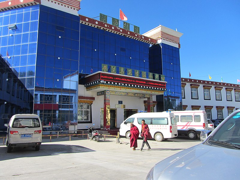
- HOSPITALS – 醫院
- tibettravel.org – Hospitals in Ngari- backgrounder
- chinadaily.com.cn – Hospitals in Ngari- backgrounder
- topchinatravel.com – Hospitals in Ngari- backgrounder
- globaltimes.cn – Hospitals in Ngari- backgrounder
- fmprc.gov.cn – Hospitals in Ngari- backgrounder
- chinaculture.org – Hospitals in Ngari- backgrounder
- chinadailyhk.com – Hospitals in Ngari- backgrounder
- cctv.com – Hospitals in Ngari- backgrounder
- MEDICINE – 藥品
- biomedcentral.com – Medicine in Ngari – backgrounder
- chinadaily.com.cn – Medicine in Ngari – backgrounder
- jstor.org – Medicine in Ngari – backgrounder
- cctv.com – Medicine in Ngari – backgrounder
- xinhuanet.com – Medicine in Ngari – backgrounder
- PUBLIC HEALTH – 公共衛生
- wunderground.com – Daily air quality & pollen conditions in Ngari Prefecture @ Weather Underground . com
- oup.com – Public health in Ngari Prefecture – backgrounder
- mdpi.com – Public health in Ngari Prefecture – backgrounder
- springeropen.com – Public health in Ngari Prefecture – backgrounder
- chinadaily.com.cn – Public health in Ngari Prefecture – backgrounder
- fmprc.gov.cn – Public health in Ngari Prefecture – backgrounder
- biomedcentral.com – Public health in Ngari Prefecture – backgrounder
- hortidaily.com – Public health in Ngari Prefecture – backgrounder
LOCAL TIME / DATE – 當地時間 / 日期
- LOCAL TIME / DATE – 當地時間 / 日期
- timeanddate.com – Time & Date in Tibet @Time and Date . com
- timeanddate.com – Time & Date in Tibet @
- timeanddate.com – Time & Date in Tibet @
- studybuddhism.com – Time & Date in Tibet @
MAPS – 地图
- MAPS – 地图
- mapcarta.com – Ngari Prefecture @ Mapcarta . com
- researchgate.net – Ngari Prefecture @ Research Gate . net
- snowliontours.com – Ngari Prefecture @ Snow Lion Tours . com
- travelchinaguide.com – Ngari Prefecture @ Travel China Guide . com
- greattibettour.com – Ngari Prefecture @ Great Tibet Tour . com
- google.com – Ngari Prefecture @ Google Maps . com
- bing.com – Nagari Prefecture @ Bing Maps . com
* * * * * * * *
NOTE : This page contains links to our ”favorite” and “most useful” websites . . .
but the CloudBridge Project does not endorse or guarantee
any of the products or services available
through the links on the pages of this website.
本站包含了我們的 “最愛” 以及 “最有用” 的網站連結,
但雲橋語文計劃並不保證其連結的有效性或對其背書.
Welcome to send us an email with your thoughts or comments:
欢迎用电子邮件的方式分享您的意见和建议:
LATEST PAGE UPDATE: August 22, 2021.
最後一次更新時間為: 2021/08/22.
Copyright ©2021 CloudBridge Project. All rights reserved.
版權所有 ©2021 雲橋語文計劃. 保留所有權利.
